Google uses artificial intelligence technology to find millions of buildings on the satellite map that were previously difficult to locate. These can now be used for humanitarian aid or other purposes. Google utilized its building detection model (Continental-Scale Building Detection from High Resolution Satellite Imagery) to create an Open Buildings dataset, containing locations and footprints of 516 million buildings with coverage across most African continent countries.
In this data set, there are millions of buildings that have not been discovered in the past. These newly-discovered building materials will help the outside world understand African populations and where they live, facilitating health care services such as education or vaccination to their communities.
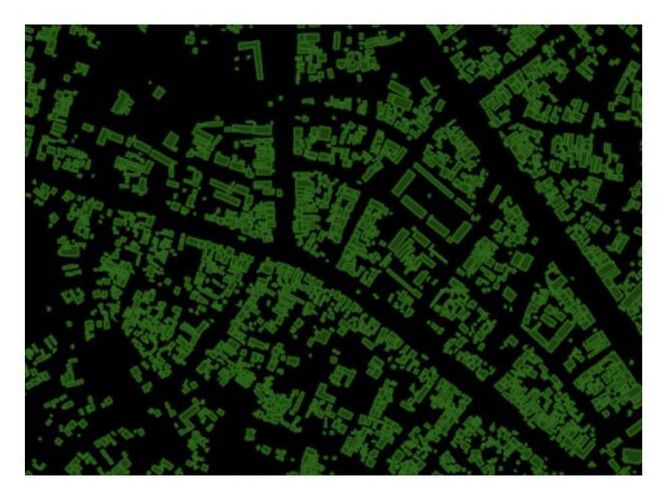
Google’s team of developers built a training set for their building detection model by manually labeling 1.75 million buildings in 100k images to make the most accurate identification possible, even when dealing with rural or urban environments that have vastly different properties and features. The need to identify what kind of dwelling place is being captured was especially difficult during scoping missions in remote areas where natural landmarks were plentiful. At the same time, dense surroundings made it hard to differentiate between multiple structures on an aerial image at once.