A team of oceanographers at the Scripps Institution of Oceanography, working with a colleague from Chungnam National University and another from the University of Hawaii, has mapped 19,000 previously unknown undersea volcanoes in the world’s oceans using radar satellite data. In their paper published in the journal Earth and Space Science, the group describes how they used radar satellite data to measure seawater mounding to find and map undersea volcanoes and explains why it is important that it be done.
The ocean floor, like dry land masses, features a wide variety of terrain. And as with dry land, features that truly stand out are mountains—in the ocean they are called seamounts. And as on land, they can be created by tectonic plates pushing against one another, or by volcanos erupting. Currently, just one-fourth of the sea floor has been mapped, which means that no one knows how many seamounts exist, or where they might be. This can be a problem for submarines—twice U.S. submarines have collided with seamounts, putting such vehicles and their crew at risk. But not knowing where the seamounts are located presents another problem. It prevents oceanographers from creating models depicting the flow of oceanwater around the world.
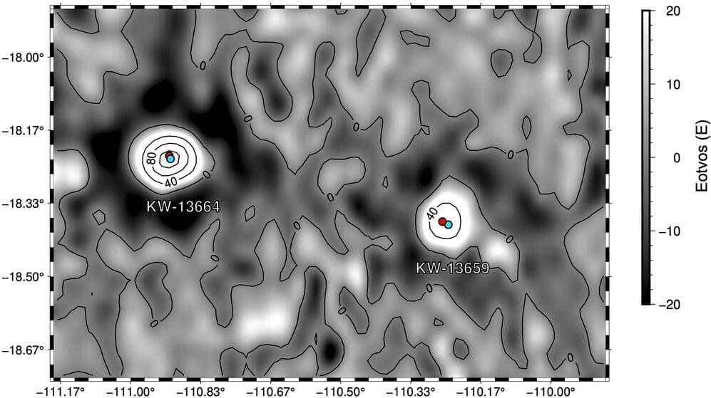
In this new effort, the research team set themselves the task of discovering and mapping as many seamounts as possible, and to do it, they used data from radar satellites. Such satellites cannot actually see the seamounts, of course, instead they measure the altitude of the sea surface, which changes due to changes in gravitational pull related to seafloor topography; an effect known as sea mounding. In so doing, they found 19,000 previously unknown seamounts.