Google Maps can now calculate rooftops’ solar potential, track air quality, and forecast pollen counts.
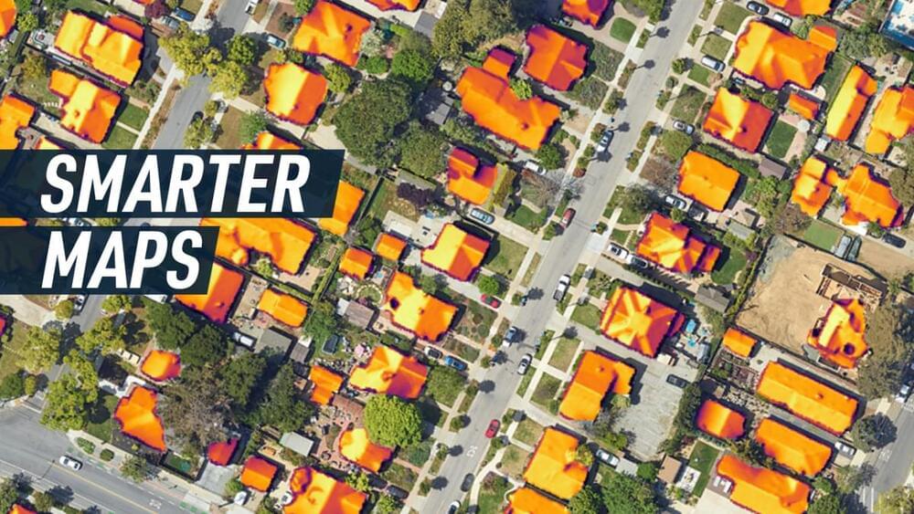
The platform recently launched a range of services like Solar API, which calculates weather patterns and pulls data from aerial imagery to help understand rooftops’ solar potential. The tool aims to help accelerate solar panel deployment by improving accuracy and reducing the number of site visits needed.
As seasonal allergies get worse every year, Pollen API shows updated information on the most common allergens in 65 countries by using a mix of machine learning and wind patterns. Similarly, Air Quality API provides detailed information on local air quality by utilizing data from multiple sources, like government monitoring stations, satellites, live traffic, and more, and can show areas affected by wildfires too.