Google is launching new updates for Maps that are part of its plan to make the navigation app more immersive and intuitive for users, the company announced today at its event in Paris.
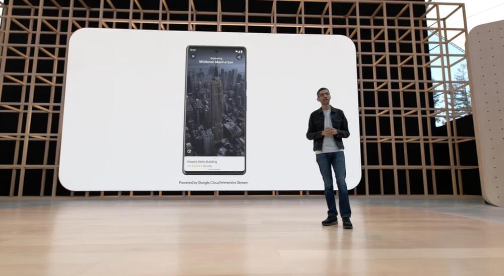
Most notably, the company announced that Immersive View is rolling out starting today in London, Los Angeles, New York, San Francisco and Tokyo. Immersive View, which Google first announced at I/O in May 2022, is designed to help you plan ahead and get a deeper understanding of a city before you visit it. The company plans to launch Immersive View in more cities, including Amsterdam, Dublin, Florence and Venice in the coming months.
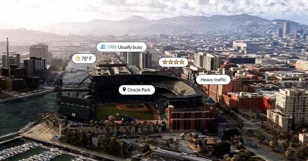
The feature fuses billions of Street View and aerial images to create a digital model of the world. It also layers information on top of the digital model, such as details about the weather, traffic and how busy a location may be. For instance, say you’re planning to visit the Rijksmuseum in Amsterdam and want to get an idea of it before you go. You can use Immersive View to virtually soar over the building to get a better idea of what it looks like and where the entrances are located. You can also see what the area looks like at different times of the day and what the weather will be like. Immersive View can also show you nearby restaurants, and allows you look inside them to see if they would be an ideal spot for you.
“To create these true-to-life scenes, we use neural radiance fields (NeRF), an advanced AI technique, transforms ordinary pictures into 3D representations,” Google explained in a blog post. “With NeRF, we can accurately recreate the full context of a place including its lighting, the texture of materials and what’s in the background. All of this allows you to see if a bar’s moody lighting is the right vibe for a date night or if the views at a cafe make it the ideal spot for lunch with friends.”
The company also announced that a new feature called “glanceable directions” is rolling out globally on Android and iOS in the coming months. The feature lets you track your journey right from your route overview or lock screen. Users will see updated ETAs and where to make your next turn. If you decide to take another path, the app will update your trip automatically. Google notes that previously, this information was only visible by unlocking your phone, opening the app and using comprehensive navigation mode. Glanceable directions can be used whenever you’re using the app, whether you’re walking, biking or taking public transit.


