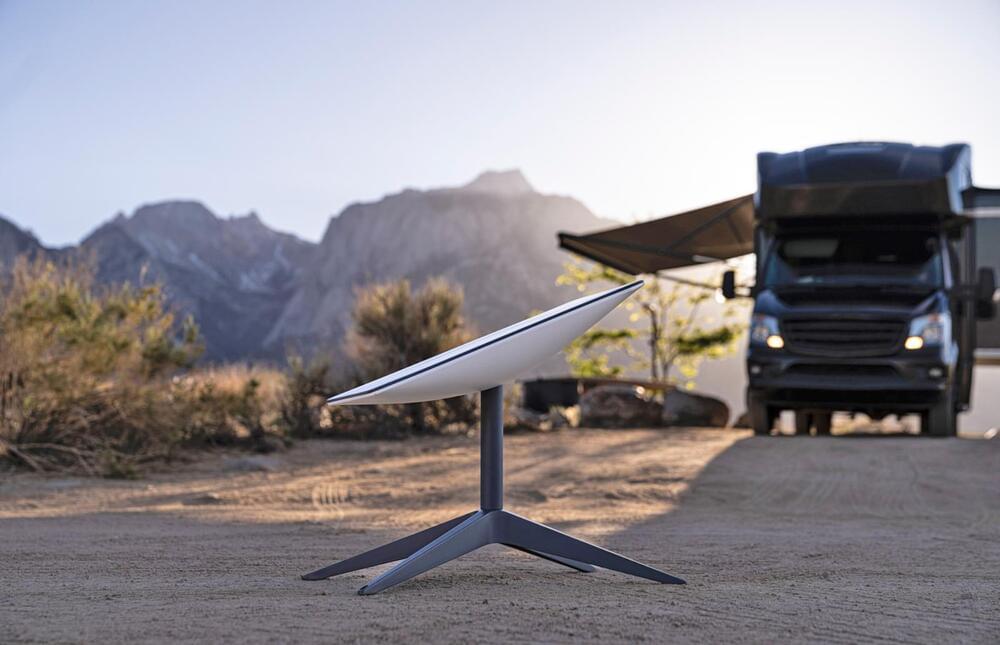
Toggle light / dark theme

In a nutshell: In the 21st century, there’s a new space race, primarily between Tesla (SpaceX) and Amazon (Blue Origin). Both are concentrating on traditional methods of launching satellites into space—namely, big rockets. However, a small space startup called SpinLaunch is developing a cheaper and environmentally cleaner way of launching satellites.

SpinLaunch is using a gigantic centrifuge to shoot stuff into space. By “stuff,” we mean things that can withstand the G-force created by being spun at 5,000 miles per hour (over 10,000 Gs), which is a category of stuff that does not yet include satellites. However, it did launch a missile-like projectile tens of thousands of feet into the air last month, using only 20 percent of the accelerator’s power.

The design is relatively simple. A carbon fiber tether holds the projectile inside a span vacuum chamber as it spins up to speed. Once the centrifuge has reached the desired velocity, the launch vehicle is released out a tube taller than the Statue of Liberty (50.4 meters). It is not unlike launching your friends off the merry-go-round when you were a kid. A more mature and controlled application of the principle would be the hammer throw event in the Olympics.

It is interesting to see Starlink evolve and move towards massive expansion. Currently, Starlink has only launched 64 laser satellites but this number should grow dramatically in the coming months. (All future Starlink satellites will include lasers.)

Their new Starlink dish will be a lot cheaper to produce which is important as originally the first Starlink dish cost $3,000 to make and SpaceX was selling it for $500. It has already gone through multiple generations and this rectangular dish should cost around $650 to make. (With the original dish, if they had sold a million of them, they would have lost 2.5 billion dollars which would have been painful.)


SpaceX has unveiled a new Starlink satellite dish, sporting a new rectangular design for customers in the United States. The company’s website is showing the new design for visitors showing U.S. IP addresses.

Canadian visitors, for example, are still seeing the old design, as the new dish is not available outside the U.S. yet.

O,.o.


A near-Earth asteroid known as Kamo‘oalewa might be made of a stray chunk of the Moon, scientists have said.

Kamo‘oalewa is one of a mysterious and little-understood set of objects called quasi-satellites. It is an asteroid that orbits around the Sun but remains close to the Earth.

As with all objects of that type, Kamo‘oalewa is difficult to observe. Though it is relatively close to the Earth – it comes as close as 9 million mile away – it is also very faint, about 4 million times darker than the faintest star humans can see in the sky.

Sandia National Laboratories is developing an avocado-sized vacuum chamber made out of titanium and sapphire that could one day use quantum mechanical sensors to provide GPS-grade navigation without the need for satellites.

In only a few short decades, GPS has gone from a military technology to finding so many everyday applications that modern society is now dependent on it. However, GPS is not always available in places like high polar latitudes or in deep mountain valleys, and it can be jammed or spoofed.

The vulnerability of GPS and similar systems lies in their dependence on constellations of satellites that orbit the Earth. These satellites emit time-stamped signals that are synced to atomic clocks. Using these signals, a GPS receiver in something as small as a wristwatch can use the Doppler effect on the satellite signals as they pass overhead to make an extremely precise fix on the receiver’s position and velocity. If these signals are interrupted or corrupted, the system fails.

*To date, most studies have focused on understanding how much carbon is stored above ground (in trees and other plants, for example). This research, however, revealed that when you look below ground and get into deeper levels of soil, there are massive deposits of carbon.*

Canada’s first-ever national carbon map reveals the location of billions — yes, billions — of tonnes of carbon stored in ecosystems across the country. This data, and how we use it, could alter the pace of climate change.

Over the span of two years, researchers fed data from existing soil samples collected from across the country, as well as long-term satellite data and topographic and climate variables, into a machine-learning algorithm. Researchers were able to estimate carbon at a 250-metre spatial resolution in different carbon pools (soils and plant biomass), as well as at multiple depths (1−2 metres).

Tens of thousands of field measurements were fed into a machine-learning algorithm to train satellite observations, including space-based laser scanning data, to estimate carbon stocks in plant biomass and soils across Canada. The resulting national carbon map will have a huge impact on the way conservation activities and policies are approached to prioritize nature-based climate solutions.

## ORIGINAL PAPER

Large soil carbon storage in terrestrial ecosystems of Canada

Saddle up.

Why use unsustainable rocket propellants for small satellite launches when you could just catapult them into space?

It might sound like a mad proposition, but a California-based startup, SpinLaunch, is actually developing an alternative rocket launch technology that spins a vacuum-sealed centrifuge at several times the speed of sound before releasing the payload, launching it like a catapult up into orbit.… See more.

China’s military has built a fake US Navy aircraft carrier and other warships for possible missile target practice, according to new satellite images published Sunday.

The images, captured by Colorado-based satellite imagery company Maxar Technologies, show a full-scale outline of a carrier and at least two Arleigh Burke-class destroyers at what appears to be a new target range complex in the Taklamakan Desert, part of China’s notorious Xinjiang province.

One of the mockups included the funnels and weapons systems featured on the destroyers, according to an analysis by the US Naval Institute.

“We are absolutely losing some science,” Jonathan McDowell, an astronomer at the Harvard-Smithsonian Center for Astrophysics, tells The Register. “How much science we lose depends on how many satellites there end up being. You occasionally lose data. At the moment it’s one in every ten images.”

Telescopes can try waiting for a fleet of satellites to pass before they snap their images, though if astronomers are trying to track moving objects, such as near-Earth asteroids or comets, for example, it can be impossible to avoid the blight.

“As we raise the number of satellites, there starts to be multiple streaks in images you take. That’s no longer irritating, you really are losing science. Ten years from now, there may be so many that we can’t deal with it,” he added.

The year is 1,972 the final Apollo mission to the moon has just been completed and President Nixon has announced a new American Spacecraft. “This is the largest spacecraft ever launched by man, the first winged spaceship” “The world’s first reusable spacecraft” The Space Shuttle.

Capable of carrying several astronauts as well as large satellites into Earth’s orbit. This new idea for a reusable spacecraft was meant to drastically reduce the cost of getting into orbit, and although the Space Shuttle did complete hundreds of successful missions, it never really lived up to everything it promised to be.

Today, we have SpaceX making another attempt to cut the cost of getting into space. But what are they doing differently? How do we know the BFR won’t become another Space Shuttle?