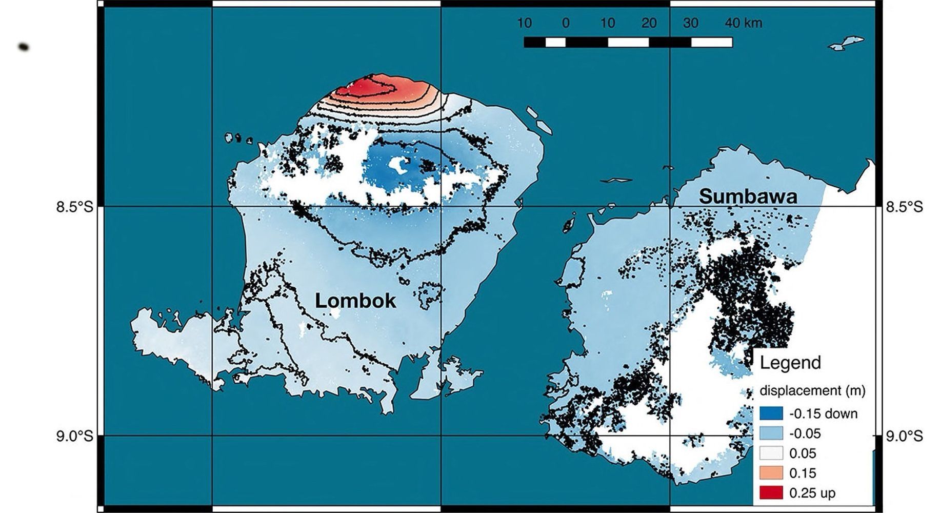
Using satellite images of Lombok from the days following the Aug. 5 quake, scientists from NASA and the California Institute of Technology’s joint rapid imaging project made a ground deformation map and measured changes in the island’s surface.
In the northwest of the island near the epicenter, the rupturing faultline lifted the earth by a quarter of a meter. In other places it dropped by 5–15 centimeters (2−6 inches).
NASA said satellite observations can help authorities respond to earthquakes and other natural or manmade disasters.