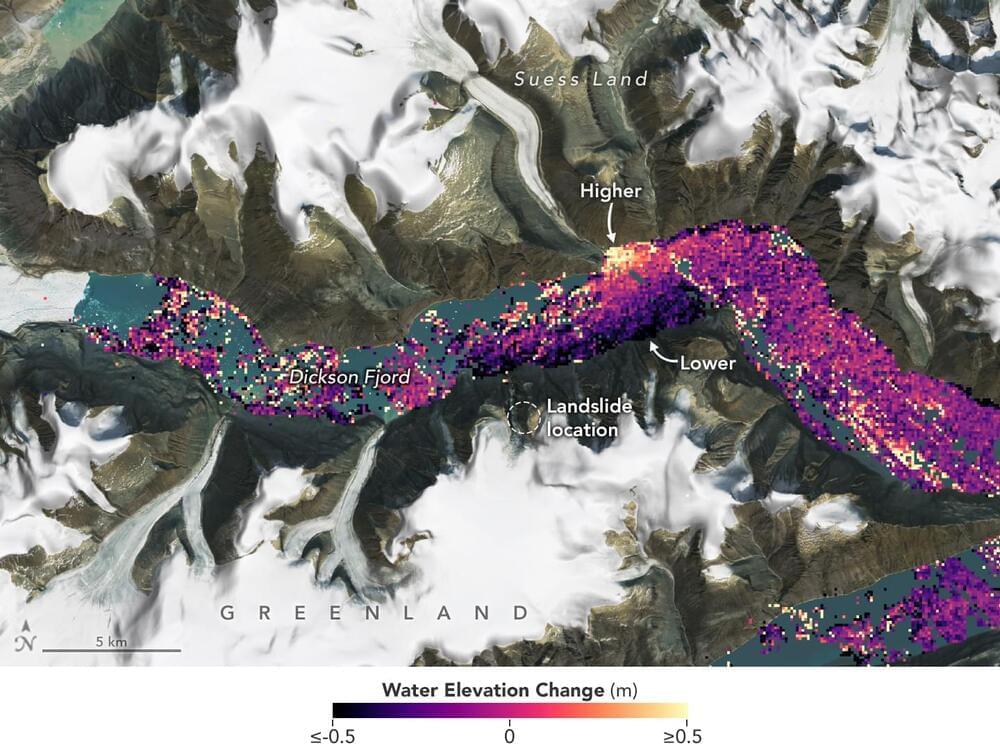
Data from space shows water tilting up toward the north side of the Dickson Fjord as it sloshed from south to north and back every 90 seconds for nine days after a 2023 rockslide.
The international Surface Water and Ocean Topography (SWOT) satellite mission, a collaboration between NASA and France’s CNES (Centre National d’Études Spatiales), detected the unique contours of a tsunami that sloshed within the steep walls of a fjord in Greenland in September 2023. Triggered by a massive rockslide, the tsunami generated a seismic rumble that reverberated around the world for nine days. An international research team that included seismologists, geophysicists, and oceanographers recently reported on the event after a year of analyzing data.
The SWOT satellite collected water elevation measurements in Dickson Fjord on Sept. 17, 2023, the day after the initial rockslide and tsunami. The data was compared with measurements made under normal conditions a few weeks prior, on Aug. 6, 2023.


Leave a reply